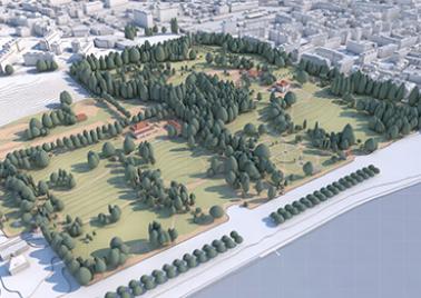
Computerised landscape modelling

MENU Computerised landscape modelling
StorIE21

StorIE21

This project shows the results of the calculation of the ecological infrastructure of the Canton of Geneva in the form of a storymap describing:

Photo Anières 3D

Anières3D

3D visualization of the development project at the heart of the municipality including the generation of an existing framework in 3D, the modelling of the planned developments, an immersive virtual tour from 360° photo shots and photomontage based on these photos, the producti

photo Montfleury 3D

Montfleury3D

3D visualization of the Montfleury connecting road project, through the production of an explanatory animation film.

Terr4D

The project aims to develop a method for the creation of historical 3D virtual mock-ups of the Swiss territory.

Modélisation projet carmaco

CARMACO

Based on drone flights to carry out an accurate survey of the quarry in Annecy, 3D modelling of the next steps of its extension, and production of the visuals illustrating this development.

photo mapping

HES Event

HES 2016 event: Unusual 360° views of Geneva on the theme of border and urbanity, visible through virtual reality glasses

photo jeu_dens_xxl

Jeu_dens_XXL

Creation of a complete digital solution for the canton of Geneva (urban planning office): production of a virtual reality application that can generate, in a PLQ area, a built project, then generate 3D renderings of the project, a slideshow of 3D renderings and image captures,

photo Nyon 4D

Nyon4D

Production of a 3D animation to communicate on the plans for the development of Place de la Gare, Place Perdtemps and Place du Château for the town of Nyon.

photo sig solaire

SIG-Solaire

Update to the solar land registry of the canton of Geneva with new LiDAR 2013 altimetry data, taking advantage of the resources of cloud computing developed at HEPIA.

photo cg plq

CG-PLQ

PLQ Graphical Charter: Development of a methodology for graphic representation of PLQ (localized district maps).