


- The school
- Studies and Research
- BACHELOR
- MASTER
- DOCTORATE
- RESEARCH
- TRANSDISCIPLINARITY
- POOLS
- CONTINUING EDUCATION
- Continuing education 2025-2026
- Artificial Intelligence, initiation
- Artificial Intelligence, Advanced
- Artificial intelligence open-source, ComfyUI
- Creative coding
- Engage with drawing
- Frame-by-frame animation
- Immersive Mapping : Unreal Engine & MadMapper
- 3D exhibition modeling in SketchUp
- 3D modeling, Blender
- Point cloud scanning
- Documentary podcast
- Serious games
- For students
- Studying at the HEAD
- Living in Geneva
- Tuition fees and sholarship
- Library
- Regulations and instructions
- Projects
- Events
- Press
- Partnerships and prizes
Continuing education – Point cloud scanning
Campus HEAD
Bâtiment E, Av. de Châtelaine 5,
1203 Genève et sorties sur le terrain à Genève.
Capturing objects, spaces and environments using new 3D scanning techniques and transforming them into immersive experiences.
Working with the materiality of the world, through representation, is a constant challenge. From the renovation of buildings to the curation of an exhibition, from the shooting of a film to the safeguarding of cultural heritage, point cloud scanning, or 3D scanning, has become an essential tool for capture and representation.
This course explores different methods of three-dimensional digitization, from manual reproduction from photos, to Gaussian Splatting, to terrestrial LIDAR scanning. Participants will familiarize themselves with the various tools for capturing, processing and visualizing point clouds. Several workflows will be covered to guide each participant from data acquisition to reproduction in virtual, mixed or augmented reality.
This course combines theoretical discussions, technical introductions and practical field exercises, enabling participants to acquire concrete skills through individual projects and guided work sessions.
Explore the multiple possibilities offered by point cloud surveys and discover how they can combine speed of execution with unprecedented precision and quality of representation in real time.
Target audience
This course is aimed at professionals in the fields of art, design, architecture, landscape and interior architecture, heritage, culture, museography, events and digital media who wish to integrate 3D scanning and point cloud technologies into their professional practice. In particular, the course teaches how to prepare scenographies, organize exhibition displays, survey existing sites and buildings, and digitize art and design artifacts.
It is also suitable for teachers, researchers and students interested in new forms of spatial representation and immersive technologies.
Targeted skills
Understand and become familiar with various 3D capture methods (photogrammetry, gaussian splatting, mobile LIDAR, terrestrial LIDAR)
Understand the technical principles of point clouds and new technologies known as novel views synthesis and be able to establish an appropriate workflow
Know how to process, clean and optimize data with specialized software
Be able to visualize and manipulate point clouds in an open-source environment
Learn how to publish and share 3D models via various platforms in augmented reality, virtual reality or via a web browser
Be able to integrate these technologies into creative and professional projects
Prerequisites:
No prior technical skills are required, but familiarity with computer tools, especially 3D, is recommended. Participants must have a personal computer capable of running 3D software (8GB RAM minimum, dedicated graphics card recommended). A digital camera (dedicated or via a recent smartphone) is required for capture sessions.
Course duration: 4 days
Dates: From Tuesday October 13 to Friday October 16, 2026
Schedule: 9am to 12.30 pm and 1pm to 5.00pm
Fee: 1200 CHF / HEAD Alumni - Geneva 900 CHF
Language: French (support in English or Italian possible)
Course format: theoretical courses, practical field sessions and technical workshops
Title issued: Attestation de formation continue
Credits: equivalent to 2 ECTS
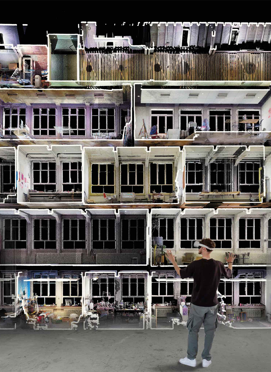
Full building section, MetaSaules - Switzerland, Based on terrestial LIDAR
© Damien Greder and data-room.xyz
© Damien Greder and data-room.xyz
© 2018 HEAD – Genève, Haute école d'art et de design