
Autonomous floating drone for river temperature mapping
The ThermEAU project, under the responsibility of Professor Zsolt Vecsernyes (inPACT institute, HEPIA), aims at assessing the impact of global warming on the survival of river fish during heat waves.
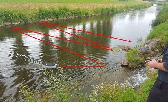
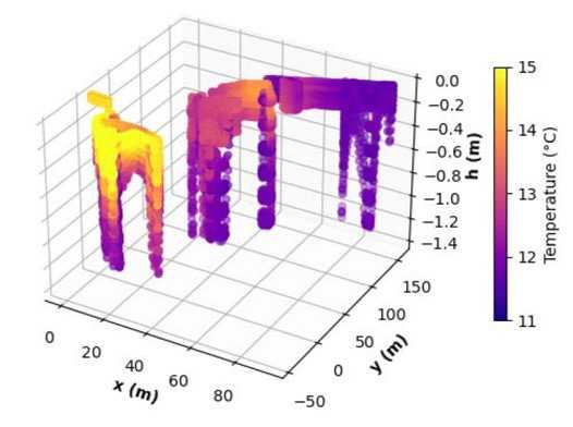
As part of this project, a drone was developed to measure in 3D and in an autonomous way the temperature of the water within the rivers.
Thermal measurements of water by conventional (flying) drones can only map the surface temperature and not the depths of the river, where pockets of cooler water (from underground streams) could be found as a refuge for fish.
The specifications of the platform were to be able to probe the parameters of the river in depth, without disturbing its environment.
A floating platform was chosen, allowing a very long autonomy compared to a flying multicopter drone, because the battery is only used for propulsion, and not to combat the effects of gravity.
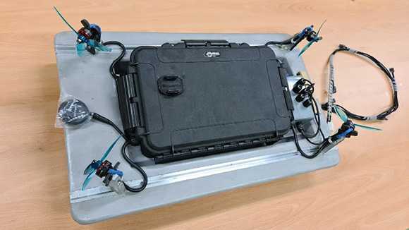
The key to the technology is an innovative propulsion system: the traditional submerged propellers have been replaced by four aerial propellers (thus imitating Florida's «airboat» for moving on swamps), linked to a quadcopter drone control architecture via a classic PixHawk autopilot.
The temperature measurement is done by a number of probes attached to a submerged cable, towed by the drone. Pressure sensors make it possible to know the instantaneous depth of each temperature sensor.
The geographical positioning of the platform (and therefore of the temperature sensors) is done via a GPS antenna. The movements of the platform are executed either by manual piloting or by a «mission» mode integrated on the drone autopilot, thus enabling an autonomous 3D scanning of the whole river.
Project partner(s)
Project leader - team
Flavio Noca
(HEPIA),
Thierry Bujard (HEPIA)
,
Fabien Fournet (étudiant Bachelor GM)
