
Context
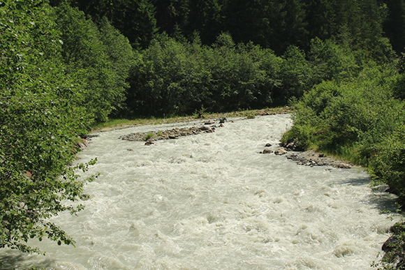
The study area concerns the upstream portion of the Bonnant River, between Notre-Dame-de-la Gorge and up to Echenaz, in the commune of Contamines-Montjoie. The stretch concerned is approximately 3 km long.
This zone is historically a sector of channel shifting, where the lateral mobility of the watercourse has been progressively limited by the construction of leisure infrastructures such as an equestrian centre, a car park, a leisure centre and a campsite. Various crossing and protection works now restrict the mobility of the torrent laterally. These developments therefore influence the flow conditions of the Bonnant and its mobility.
Between the Moranches bridge and the Nant de Rouge, the study's hydraulic models indicate that overflows at the place known as Le Lay, a residential area, are observed during a 100-year flood event. In the event of a 100-year flood of the Nant Rouge, a left bank tributary, water levels could increase significantly along with the transport of solid materials.
In parallel to this study on the Bonnant, the commune of Contamines-Montjoie wishes to develop the old EDF house located downstream of Notre-Dame-de-la-Gorge, on the left bank of the Bonnant, to become the Maison du Tour du Mont Blanc. This will provide a gateway to the Contamines-Montjoie Nature Reserve and welcome the public; in addition, the outside areas will undergo landscaping.
Objectives
The aim of this mission is to build an ambitious, concerted and sustainable restoration project for the Bonnant Amont in the commune of Contamines-Montjoie, in Haute Savoie, over a stretch of approximately 3 km.
The objective is to build a global vision for the river restoration project in this sector, in the form of a guiding vision that will have to meet different objectives:
This mission has a transdisciplinary perspective, landscape, architecture, ecology, heritage, hydromorphology, plant engineering, and co-construction with the elected officials and local actors.
After a phase of diagnosis and discussion, the mission should result in a landscape outline that will provide the overall framework for action and bring coherence to the projects carried out by the various actors in the area.
The study site is characterised by a valley floor with strong tourist pressure. There is a high density of infrastructures and facilities (car parks, leisure centres, sports facilities, cable car departures, etc.) which have considerable impact on the image and usage of the river and, in certain sectors, create degradations that are detrimental to the natural perception of the Bonnant.
It is therefore essential to restore the river to a beautiful, unified image, to a good ecological state and to develop a global approach, capable of integrating all of the existing infrastructures. The forest areas, the wooded corridors and the riparian zones should be included into the new landscape vision, concern the whole of the valley floor, and of which the river will constitute the unifying element.
Project partner(s)
Project leader - team
Pierre-André Frossard
(HEPIA)
